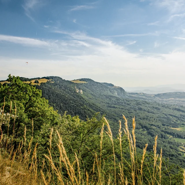
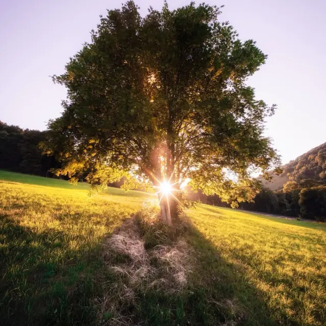
Les Voirons
|
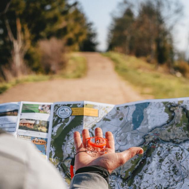
Map of the regionDiscovering Monts du Genevois
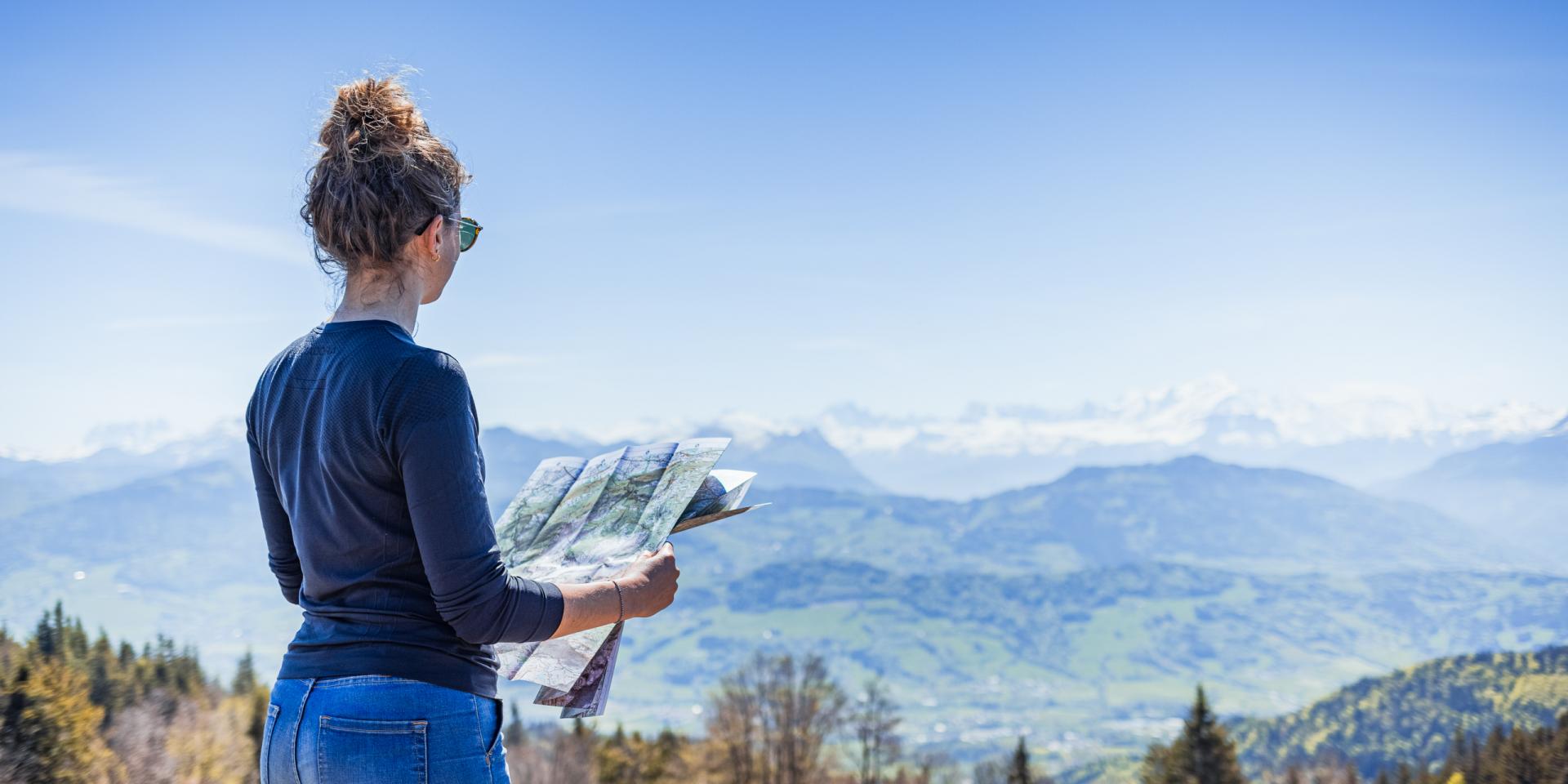
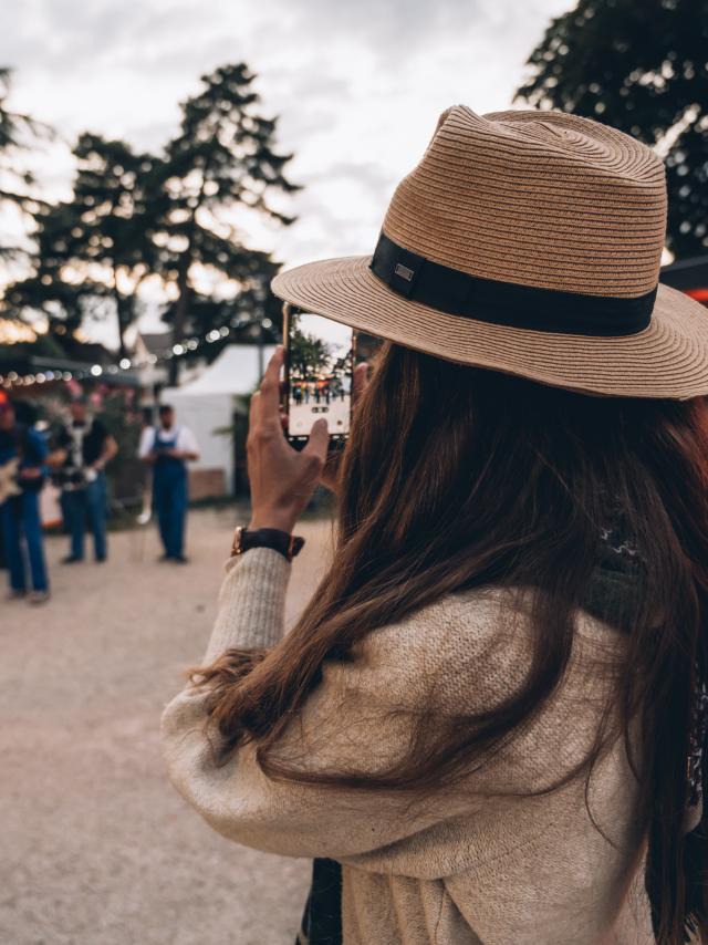
Find yourAdventure


a few seconds ago
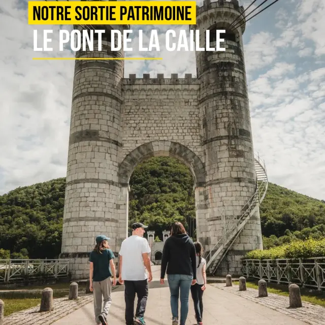
𝗣𝗿𝗲̂𝘁𝘀 𝗮̀ 𝗿𝗲𝗺𝗼𝗻𝘁𝗲𝗿 𝗹𝗲 𝘁𝗲𝗺𝗽𝘀... 𝗮𝘂-𝗱𝗲𝘀𝘀𝘂𝘀 𝗱𝗲𝘀 𝗴𝗼𝗿𝗴𝗲𝘀 𝗱𝗲𝘀 𝗨𝘀𝘀𝗲𝘀 ? ⏳🌉 Entre falaises et rivière, le Pont de la Caille se dévoile comme un véritable trait d’union entre patrimoine et nature. Ici, on s’arrête pour admirer son architecture remarquable, contempler les gorges sculptées par le temps et profiter d’un panorama qui ne laisse jamais indifférent. ✨😍 Le temps d’une balade ou simplement pour une pause au grand air, chaque passage invite à ralentir, à lever les yeux et à apprécier la beauté de ce lieu chargé d’histoire. 𝗨𝗻 𝘀𝗶𝘁𝗲 𝗲𝗺𝗯𝗹𝗲́𝗺𝗮𝘁𝗶𝗾𝘂𝗲 𝗼𝘂̀ 𝗹’𝗶𝗻𝗴𝗲́𝗻𝗶𝗼𝘀𝗶𝘁𝗲́ 𝗱𝗲𝘀 𝗵𝗼𝗺𝗺𝗲𝘀 𝗿𝗲𝗻𝗰𝗼𝗻𝘁𝗿𝗲 𝗹𝗮 𝗳𝗼𝗿𝗰𝗲 𝗱𝗲 𝗹𝗮 𝗻𝗮𝘁𝘂𝗿𝗲. 🌿 📸 @celineducrettet | 🎥 Rush @ludovicfremondiere #cruseilles #montsdugenevois #hautesavoie #france
a few seconds ago
𝗟𝗮̀ 𝗼𝘂̀ 𝗹𝗮 𝗹𝘂𝗺𝗶𝗲̀𝗿𝗲 𝗿𝗲́𝘃𝗲̀𝗹𝗲 𝗹𝗮 𝗯𝗲𝗮𝘂𝘁𝗲́ 𝗱𝘂 𝗽𝗮𝘆𝘀𝗮𝗴𝗲... ✨🌄 Nous aimons ces fins de journée où la nature nous offre son plus beau spectacle. Ici, @yoann.rivet.photographe nous emmène sur les hauteurs de Monnetier-Mornex pour un moment baigné de lumière dorée. 🔥 Un instant suspendu, bercé par le silence, où le temps semble ralentir, comme pour nous laisser savourer encore de cette douce ambiance. 😍 𝗘𝘁 𝘃𝗼𝘂𝘀, 𝗾𝘂𝗲𝗹 𝗲𝘀𝘁 𝘃𝗼𝘁𝗿𝗲 𝗲𝗻𝗱𝗿𝗼𝗶𝘁 𝗽𝗿𝗲́𝗳𝗲́𝗿𝗲́ 𝗽𝗼𝘂𝗿 𝗮𝗱𝗺𝗶𝗿𝗲𝗿 𝗹𝗲 𝗰𝗼𝘂𝗰𝗵𝗲𝗿 𝗱𝘂 𝘀𝗼𝗹𝗲𝗶𝗹 𝗱𝗮𝗻𝘀 𝗹𝗲𝘀 𝗠𝗼𝗻𝘁𝘀 𝗱𝘂 𝗚𝗲𝗻𝗲𝘃𝗼𝗶𝘀 ? 😊 Un grand merci @yoann.rivet.photographe pour ces magnifiques photos. 📸 #montsdugenevois #hautesavoie #france
a few seconds ago
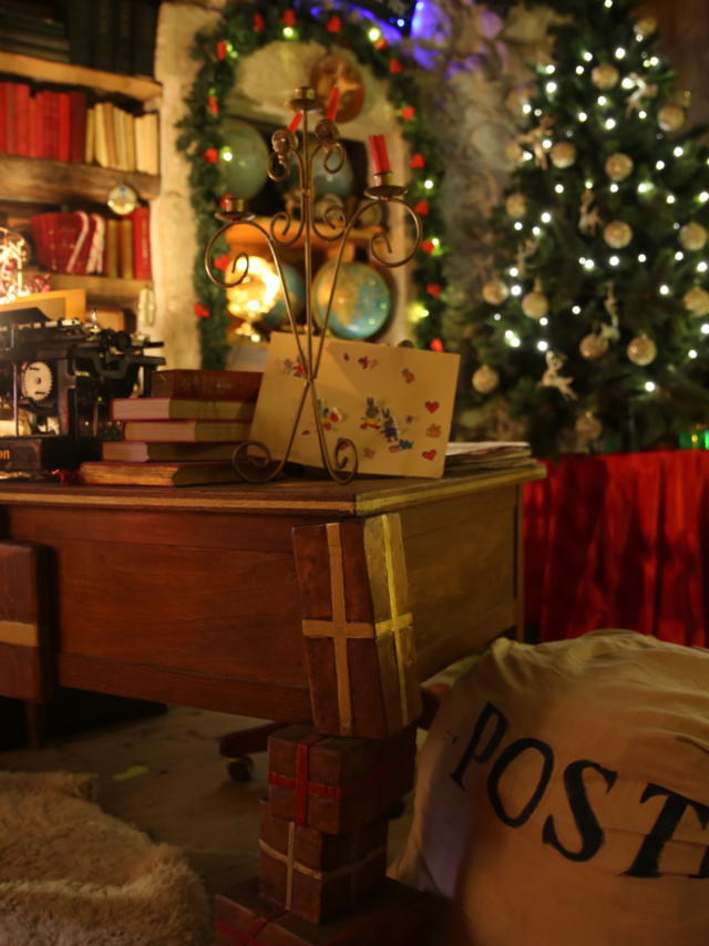
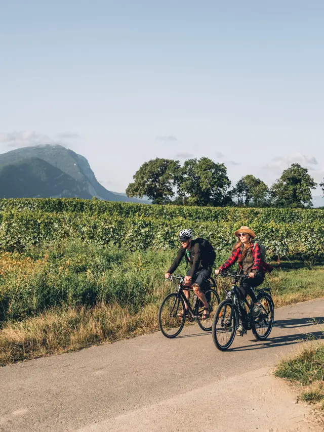
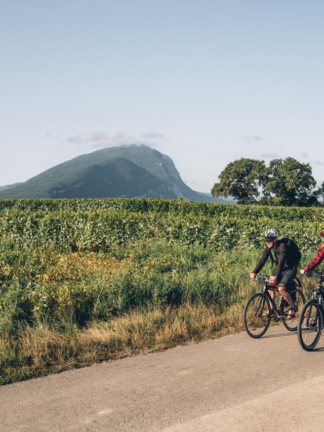
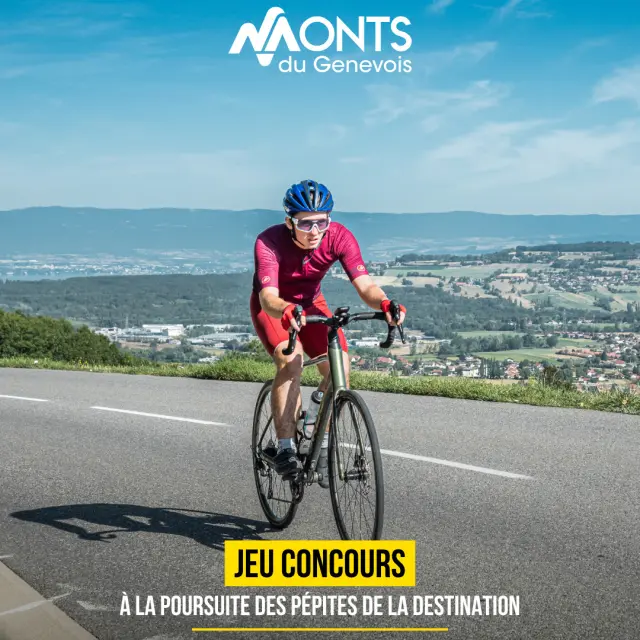
[📢 𝗝𝗘𝗨 𝗖𝗢𝗡𝗖𝗢𝗨𝗥𝗦] - 𝗔̀ 𝘃𝗼𝘁𝗿𝗲 𝗧𝗼𝘂𝗿 ! 🚴 À l'occasion du passage du Tour de France sur le Salève, on vous lance le défi de (re)découvrir la destination autrement ! Du 𝟭𝗲𝗿 𝗮𝘂 𝟯𝟭 𝗷𝘂𝗶𝗹𝗹𝗲𝘁, les Monts du Genevois deviennent un véritable terrain de jeu aux couleurs de la Grande Boucle ! 𝗘𝗻𝘃𝗶𝗲 𝗱𝗲 𝘁𝗲𝗻𝘁𝗲𝗿 𝗹'𝗮𝘃𝗲𝗻𝘁𝘂𝗿𝗲 𝗲𝘁 𝗱𝗲 𝗷𝗼𝘂𝗲𝗿 ? 𝗥𝗶𝗲𝗻 𝗱𝗲 𝗽𝗹𝘂𝘀 𝘀𝗶𝗺𝗽𝗹𝗲 ! 🗺 Décryptez les indices 🚲 Retrouvez les vélos et les bobs de la caravane sur la carte 🏔 (Re)découvrez les lieux emblématiques du territoire 🎁 Et tentez de remporter un week-end d’exception pour 2 personnes, des activités locales et de nombreux cadeaux 𝗣𝗿𝗲̂𝘁𝘀 𝗮̀ 𝘃𝗼𝘂𝘀 𝗹𝗮𝗻𝗰𝗲𝗿 𝗱𝗮𝗻𝘀 𝗹’𝗮𝘃𝗲𝗻𝘁𝘂𝗿𝗲 ? 👉 Lien à retrouver en bio. 🔗 #MontsDuGenevois #JeuConcours #HauteSavoie #France
a few seconds ago
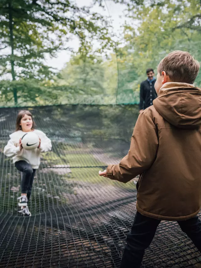
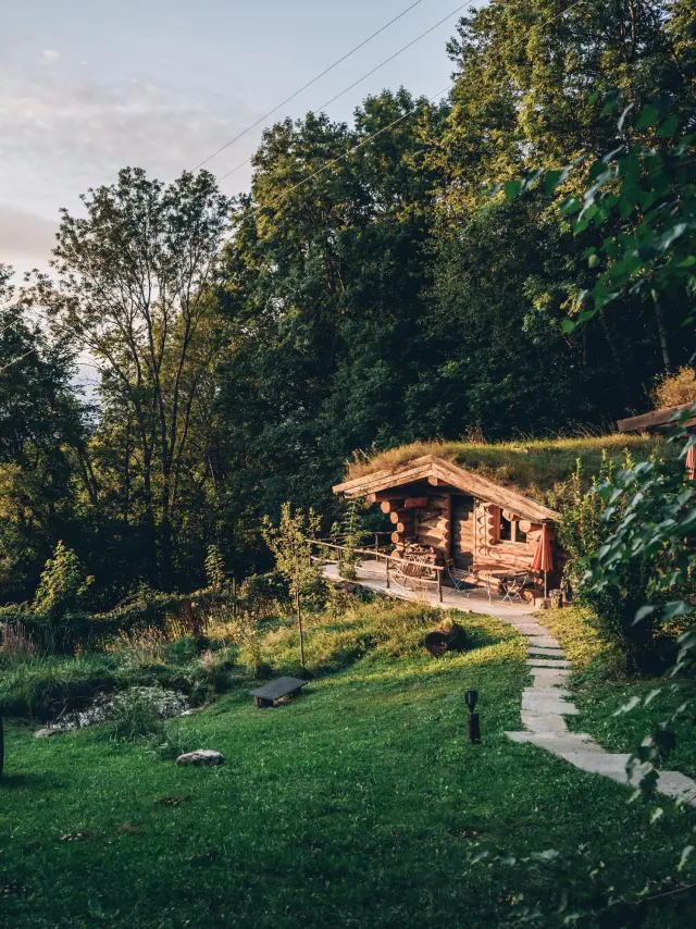
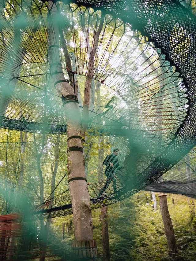
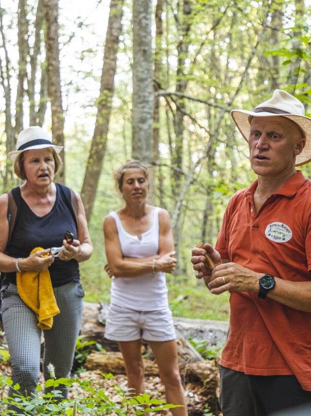
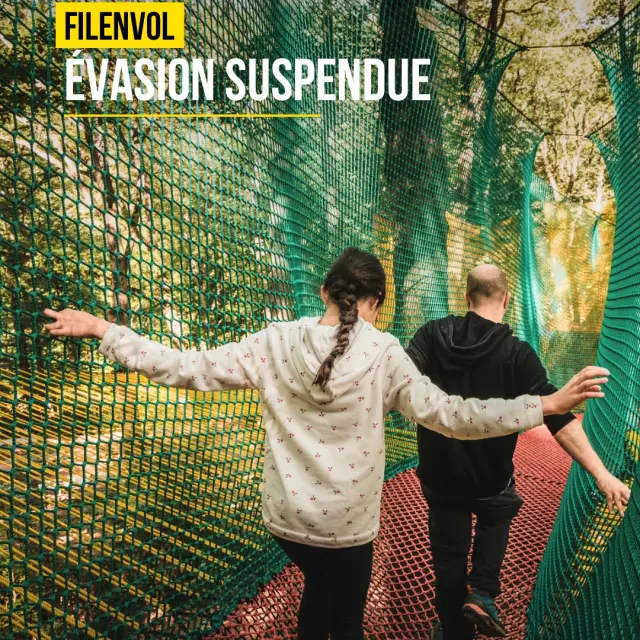
𝗣𝗿𝗲̂𝘁𝘀 𝗮̀ 𝗽𝗿𝗲𝗻𝗱𝗿𝗲 𝘂𝗻 𝗽𝗲𝘂 𝗱𝗲 𝗵𝗮𝘂𝘁𝗲𝘂𝗿... 𝗮𝘂 𝗰œ𝘂𝗿 𝗱’𝘂𝗻𝗲 𝗳𝗼𝗿𝗲̂𝘁 𝗮𝗻𝗰𝗲𝘀𝘁𝗿𝗮𝗹𝗲 ? 🌳 Sur les hauteurs de Monnetier-Mornex, les filets suspendus de @filenvol74 invitent à vivre la nature autrement. Ici, on avance entre les arbres, on observe les cimes sous un nouvel angle et l’on retrouve son âme d’enfant le temps d’une parenthèse hors du quotidien. 🤗 En famille, entre amis ou simplement pour s’accorder un moment de déconnexion, l’expérience se vit au rythme de chacun : jouer, explorer, contempler… et se laisser porter par l’instant. Une aventure aérienne où la forêt devient un véritable terrain de découverte. 🍃 𝗘𝘁 𝘀𝗶 𝘃𝗼𝘁𝗿𝗲 𝗽𝗿𝗼𝗰𝗵𝗮𝗶𝗻𝗲 𝗲𝘀𝗰𝗮𝗽𝗮𝗱𝗲 𝗽𝗿𝗲𝗻𝗮𝗶𝘁 𝗱𝗲 𝗹𝗮 𝗵𝗮𝘂𝘁𝗲𝘂𝗿 ? ✨ 📸 @celineducrettet #filenvol #montsdugenevois #hautesavoie #france
a few seconds ago
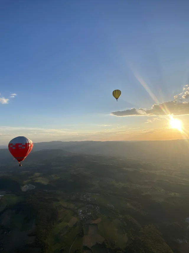
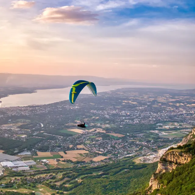
Little evening paragliding treat..! #saleve #paragliding #aerialphotography
a few seconds ago
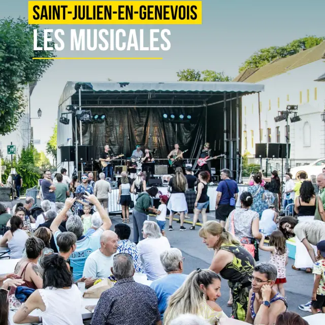
𝗤𝘂𝗮𝗻𝗱 𝗹𝗲𝘀 𝘀𝗼𝗶𝗿𝗲́𝗲𝘀 𝗱'𝗲́𝘁𝗲́ 𝗽𝗿𝗲𝗻𝗻𝗲𝗻𝘁 𝗱𝗲𝘀 𝗮𝗶𝗿𝘀 𝗱𝗲 𝗳𝗲̂𝘁𝗲… 🌞🎵 Il y a ces rendez-vous que l'on attend avec impatience. Ceux qui rassemblent, qui font vibrer le cœur de nos villes et qui donnent à l'été une saveur particulière. 🫶 Du 𝟮𝟲 𝗷𝘂𝗶𝗻 𝗮𝘂 𝟵 𝗷𝘂𝗶𝗹𝗹𝗲𝘁, @les_musicales_stju reviennent à Saint-Julien-en-Genevois pour une nouvelle édition placée sous le signe du partage et de la découverte. Au fil des soirées, les notes de pop, de rock et de country résonneront dans une ambiance festive et chaleureuse. 𝗔𝘂 𝗽𝗿𝗼𝗴𝗿𝗮𝗺𝗺𝗲 : 🎤 Des concerts gratuits et accessibles à tous 🎸 Des artistes à découvrir 😋 Une buvette et de la restauration aux saveurs locales Ici, entre rencontres et bonne humeur, on profite simplement de ces instants qui font le charme de ces soirées d'été. Tous les ingrédients sont réunis pour célébrer l'été au rythme de la musique. ✨ 𝗘𝘁 𝘃𝗼𝘂𝘀, 𝗮𝘃𝗲𝗰 𝗾𝘂𝗶 𝘃𝗶𝗲𝗻𝗱𝗿𝗲𝘇-𝘃𝗼𝘂𝘀 𝗽𝗿𝗼𝗳𝗶𝘁𝗲𝗿 𝗱𝗲𝘀 𝗠𝘂𝘀𝗶𝗰𝗮𝗹𝗲𝘀 𝗰𝗲𝘁𝘁𝗲 𝗮𝗻𝗻𝗲́𝗲 ? 😀 Retrouvez toutes les infos pratiques ici ! 👉 @les_musicales_stju 📸 @les_musicales_stju - © Vincent Brunetière #montsdugenevois #hautesavoie #france
a few seconds ago
𝗟𝗲 𝗦𝗮𝗹𝗲̀𝘃𝗲 𝗲𝘁 𝗹𝗲 𝗧𝗼𝘂𝗿 𝗱𝗲 𝗙𝗿𝗮𝗻𝗰𝗲 : 𝘂𝗻𝗲 𝗵𝗶𝘀𝘁𝗼𝗶𝗿𝗲 𝗿𝗮𝗿𝗲 𝗺𝗮𝗶𝘀 𝗺𝗮𝗿𝗾𝘂𝗮𝗻𝘁𝗲 Comptabilisant quatre passages en plus de 120 ans de Tour de France, le Salève fait partie des ascensions les plus rares de l'histoire de la Grande Boucle. Pourtant, chaque apparition a marqué son époque ! • 1973 : le Tour découvre le Salève. Classé en 1ère catégorie, le col de la Croisette s'invite au parcours pour diversifier les difficultés. Luis Ocaña passe au sommet en tête. • 1974 : l'essai est transformé. Le Tour revient dès l'année suivante et Gonzalo Aja franchit le sommet en premier. • 1981 : reclassé en 2e catégorie, le Salève devient une difficulté de transition avant les grands cols alpins. Hendrik Devos y passe en tête. • 1992 : retour en 1ère catégorie. Fabrice Philipot franchit le sommet en premier avant que le massif ne disparaisse du parcours pendant plus de trente ans. 👉 2026, le Tour retrouve enfin le Salève et le col de la Croisette - rdv le 19 juillet ! montsdugenevois 📸 Alpcat_Medias / Céline Ducrettet / Brice Souvansanouk #routedesgrandesalpes #saleve #tourdefrance #coldelacroisette #hautesavoie #cyclisme #veloderoute #histoireduvelo #cycliste #grandscols
a few seconds ago
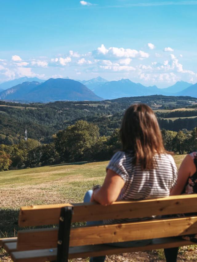
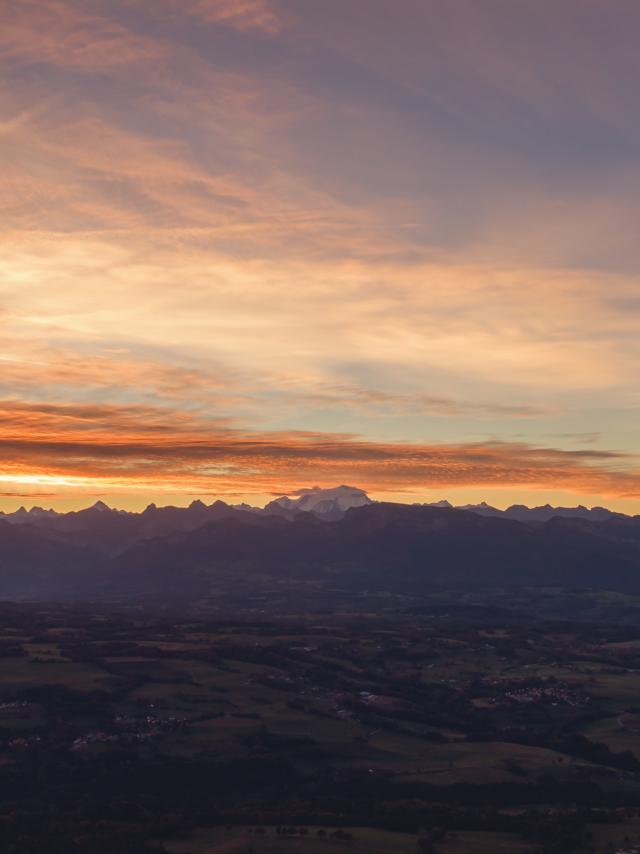
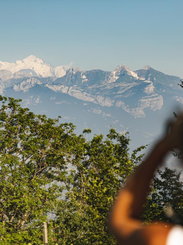
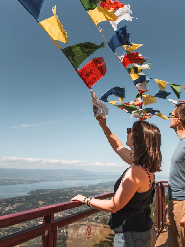
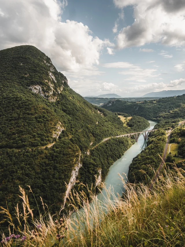
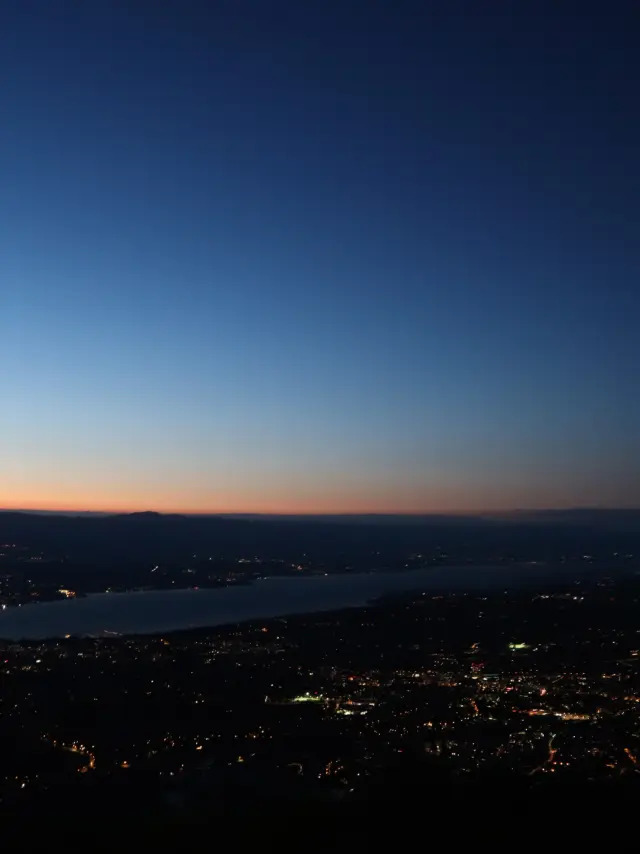
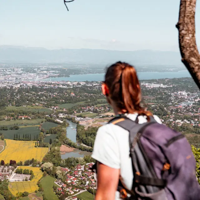
𝗟𝗮̀ 𝗼𝘂̀ 𝗹𝗲 𝗿𝗲𝗴𝗮𝗿𝗱 𝗽𝗼𝗿𝘁𝗲 𝗽𝗹𝘂𝘀 𝗹𝗼𝗶𝗻 𝘃𝗲𝗿𝘀 𝗹'𝗵𝗼𝗿𝗶𝘇𝗼𝗻. 👀 Depuis les pentes du Salève, le regard s'évade. L'Arve se dessine dans la vallée, Genève et son jet d'eau se dévoilent et le Léman se fond dans les nuances du ciel. Ici, chaque éclaircie, chaque saison et chaque heure de la journée offrent un paysage différent. ✨ Nous aimons ces lieux qui nous invitent à ralentir. Ces instants où l'on s'arrête quelques minutes, simplement pour observer. Parce que certains panoramas ont ce pouvoir rare : celui de nous révéler la beauté de tout ce qui nous entoure. 🥰 𝗘𝘁 𝘃𝗼𝘂𝘀, 𝗾𝘂𝗲𝗹 𝗲𝘀𝘁 𝘃𝗼𝘁𝗿𝗲 𝗽𝗮𝗻𝗼𝗿𝗮𝗺𝗮 𝗽𝗿𝗲́𝗳𝗲́𝗿𝗲́ 𝗱𝗮𝗻𝘀 𝗹𝗲𝘀 𝗠𝗼𝗻𝘁𝘀 𝗱𝘂 𝗚𝗲𝗻𝗲𝘃𝗼𝗶𝘀 ? ⛰ ⚠ Avant de prendre de la hauteur, pensez à bien vous équiper ! Emportez suffisamment d’eau pour vous hydrater et adaptez vos sorties aux conditions du jour. La montagne se savoure en toute sécurité. 💧🥾🎒 📸 OT Monts du Genevois - @brice_svsnk #montsdugenevois #saleve #hautesavoie #france
a few seconds ago
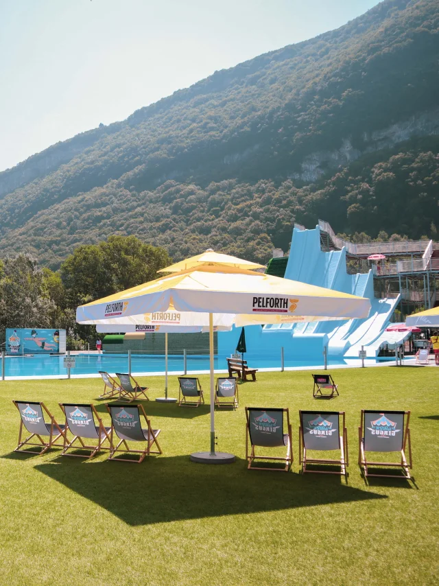
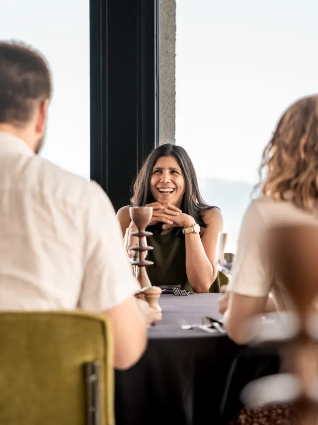
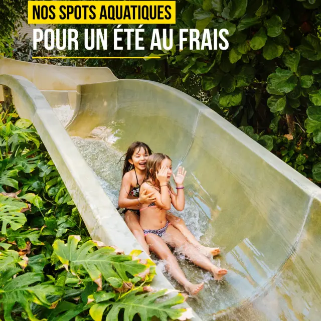
𝗤𝘂𝗮𝗻𝗱 𝗹𝗮 𝗰𝗵𝗮𝗹𝗲𝘂𝗿 𝘀’𝗶𝗻𝘀𝘁𝗮𝗹𝗹𝗲, 𝗹’𝗲𝗮𝘂 𝗱𝗲𝘃𝗶𝗲𝗻𝘁 𝘂𝗻𝗲 𝗶𝗻𝘃𝗶𝘁𝗮𝘁𝗶𝗼𝗻. 💦☀ Les journées s’étirent sous le soleil, la chaleur s’installe... Et une seule envie nous revient : 𝗰𝗲𝗹𝗹𝗲 𝗱𝗲 𝘀𝗲 𝗿𝗮𝗳𝗿𝗮𝗶̂𝗰𝗵𝗶𝗿 ! Prendre le temps de flotter, s’amuser en famille, se détendre au bord d’un bassin ou simplement profiter d’un instant de fraîcheur… Ici, chacun trouve sa façon de savourer l’été. ☺ 🧡 À Neydens, l'𝗨𝗖𝗣𝗔 𝗩𝗶𝘁𝗮𝗺 nous promet une journée riche en sensations entre cascades, rivière sauvage, toboggans et espaces de détente. 💚 À Cruseilles, le 𝗖𝗲𝗻𝘁𝗿𝗲 𝗻𝗮𝘂𝘁𝗶𝗾𝘂𝗲 𝗱𝗲𝘀 𝗗𝗿𝗼𝗻𝗶𝗲̀𝗿𝗲𝘀 nous invite à profiter des beaux jours en plein air, avec le Salève en toile de fond. 💙 À Annemasse, le 𝗖𝗵𝗮̂𝘁𝗲𝗮𝘂 𝗕𝗹𝗲𝘂 nous offre une parenthèse de bien-être où sport, relaxation et douceur se rencontrent. (Un équipement @annemasseagglo) Trois lieux, trois ambiances, mais une même invitation : profiter pleinement de l’été, au fil de l’eau. ✨ 𝗘𝘁 𝘃𝗼𝘂𝘀, 𝗾𝘂𝗲𝗹𝗹𝗲 𝘀𝗲𝗿𝗮 𝘃𝗼𝘁𝗿𝗲 𝗽𝗿𝗼𝗰𝗵𝗮𝗶𝗻𝗲 𝗽𝗮𝘂𝘀𝗲 𝗳𝗿𝗮𝗶̂𝗰𝗵𝗲𝘂𝗿 ? 🌊 📸 @celineducrettet | © Communauté de Communes du Pays de Cruseilles - Thomas Garcia | © Château Bleu - Stéphane Couchet #montsdugenevois #hautesavoie #france