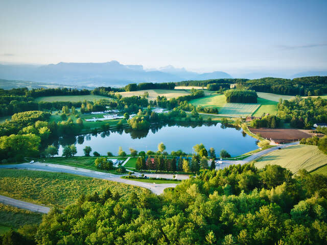
125,02 km² (125,02 sq mi)
14107 inhabitants
13 municipalities
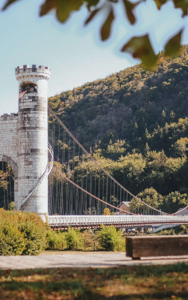
 Pont De La Caille Pont Charles Albert Ot Monts De Geneve A.modylevskaia 2554 1400px
Allonzier La Caille – Andilly – Cercier – Cernex – Copponex – Cruseilles – Cuvat – Le Sappey – Menthonnex-en-Bornes – Saint-Blaise – Villy-le-Bouveret – Villy-le-Pelloux – Vovray-en-Bornes
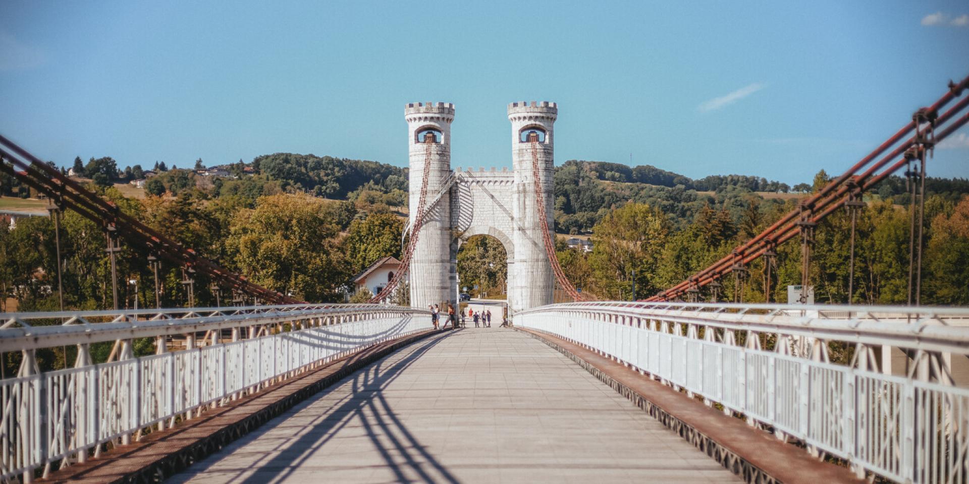
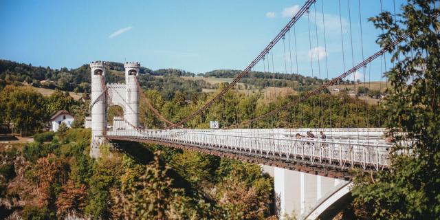 Quail Bridge (Charles-Albert Bridge) -OT_Geneva_Mountains-_A.Modylevskaia-2550-1400px
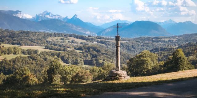 Panoramic view of Le Massif Des Bornes Ot Monts De Geneve A.modylevskaia 2566 1400px
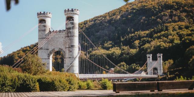 Pont De La Caille Pont Charles Albert Ot Monts De Geneve A.modylevskaia 2544 1400px
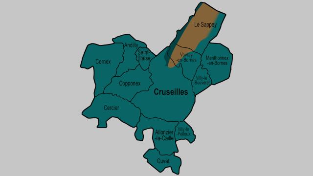 CCPC Card (1)
Communauté de Communes du Pays de Cruseilles
268 route du Suet
74350 Cruseilles
04 50 08 16 16
Reception: Monday through Thursday from 8:30 a.m. to 12 p.m. and 2 p.m. to 5 p.m., and Friday from 8:30 a.m. to 12 noon and 2 p.m. to 4 p.m.

𝗨𝗻 𝗶𝗻𝘀𝘁𝗮𝗻𝘁 𝘀𝘂𝘀𝗽𝗲𝗻𝗱𝘂, 𝗮̀ 𝗽𝗮𝗿𝘁𝗮𝗴𝗲𝗿 𝗮𝘂𝘅 𝗱𝗲𝗿𝗻𝗶𝗲̀𝗿𝗲𝘀 𝗹𝘂𝗲𝘂𝗿𝘀 𝗱𝘂 𝗷𝗼𝘂𝗿. ✨🤗 Là‑haut, le jour s’efface doucement, le ciel se teinte de couleurs chaudes et le froid se fait lentement oublier. Ici, @andrea_caramello nous emmène au Signal des Voirons pour un moment suspendu. Un instant à partager à deux, face aux paysages qui s’apaisent. L’hiver offre aussi ces parenthèses rares... celles qui rapprochent et qui invitent simplement à prendre le temps. 😌 𝗘𝘁 𝘃𝗼𝘂𝘀, 𝗱’𝗼𝘂̀ 𝗽𝗿𝗲́𝗳𝗲́𝗿𝗲𝘇‑𝘃𝗼𝘂𝘀 𝗮𝗱𝗺𝗶𝗿𝗲𝗿 𝗹𝗲𝘀 𝗰𝗼𝘂𝗰𝗵𝗲𝗿𝘀 𝗱𝗲 𝘀𝗼𝗹𝗲𝗶𝗹 𝗱𝗮𝗻𝘀 𝗹𝗲𝘀 𝗠𝗼𝗻𝘁𝘀 𝗱𝘂 𝗚𝗲𝗻𝗲𝘃𝗼𝗶𝘀 ? 😍 Merci beaucoup @andrea_caramello pour ces belles photos. 🙏📸 #sunset #voirons #montsdugenevois #hautesavoie #france
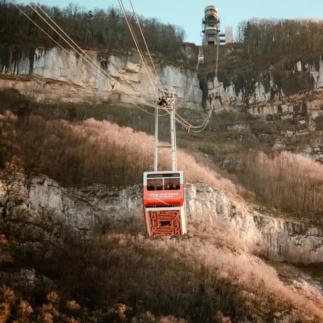
𝗟𝗲 𝘁𝗲́𝗹𝗲́𝗽𝗵𝗲́𝗿𝗶𝗾𝘂𝗲 𝗱𝘂 𝗦𝗮𝗹𝗲̀𝘃𝗲 𝗿𝗲𝗽𝗿𝗲𝗻𝗱 𝘀𝗼𝗻 𝗲𝗻𝘃𝗼𝗹 ! 🚡⛰ Nous attendions ce moment avec impatience… et il est enfin arrivé ! Le téléphérique réouvre ses portes le 17 janvier prochain après sa grande inspection quinquennale. Des instants uniques nous attendent : sentir le vent sur nos visages, admirer les panoramas à couper le souffle sur le Genevois et les montagnes alentours ou profiter simplement d’une balade inoubliable entre ciel et terre 🌄. Que ce soit en famille, entre amis ou en solo, retrouvez ces instants à vivre au téléphérique du Salève pour un vrai bol d’air frais et un dépaysement total à deux pas de la ville. 𝗔𝗹𝗼𝗿𝘀, 𝗽𝗿𝗲̂𝘁𝘀 𝗮̀ 𝗲𝗺𝗯𝗮𝗿𝗾𝘂𝗲𝗿 𝗲𝘁 𝗮̀ 𝗿𝗲𝗱𝗲́𝗰𝗼𝘂𝘃𝗿𝗶𝗿 𝗹𝗲 𝗦𝗮𝗹𝗲̀𝘃𝗲 𝗮𝘂𝘁𝗿𝗲𝗺𝗲𝗻𝘁 ? ✨ 📸 OT Monts du Genevois - @brice_svsnk #telepherique #saleve #montsdugenevois #hautesavoie #france
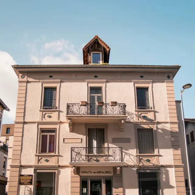
𝗨𝗻 𝗹𝗶𝗲𝘂 𝗲𝘁 𝗺𝗶𝗹𝗹𝗲 𝗵𝗶𝘀𝘁𝗼𝗶𝗿𝗲𝘀, 𝗲𝗻𝘁𝗿𝗲 𝗺𝗲́𝗺𝗼𝗶𝗿𝗲 𝗲𝘁 𝘁𝗿𝗮𝗻𝘀𝗺𝗶𝘀𝘀𝗶𝗼𝗻. 🏛🕯 Au cœur de ce lieu chargé de mémoire, chaque pierre évoque les heures sombres de la Seconde Guerre mondiale et les actes courageux de la Résistance. Ici, le passé se révèle à travers un parcours immersif où chaque détail compte. La 𝗠𝗮𝗶𝘀𝗼𝗻 𝗱𝗲𝘀 𝗠𝗲́𝗺𝗼𝗶𝗿𝗲𝘀 nous ouvre ses portes pour faire découvrir un espace muséographique moderne et interactif sur 120 m². La façade historique, soigneusement restaurée, raconte l’histoire du lieu, tandis qu’une salle pédagogique offre aux groupes scolaires une expérience éducative et immersive. Plongez dans un voyage à travers le temps pour mieux comprendre, apprendre et transmettre. ✨ 📸 OT Monts du Genevois - @brice_svsnk #MaisonDesMémoires #Annemasse #montsdugenevois #hautesavoie #france
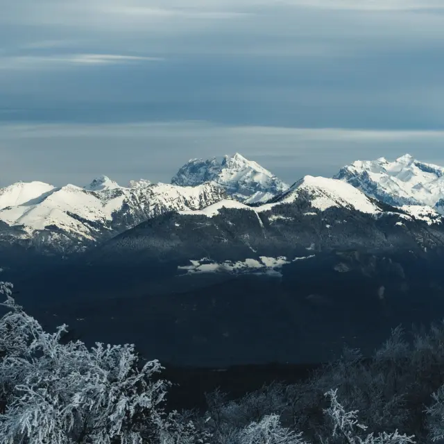
𝗨𝗻𝗲 𝘃𝘂𝗲 𝗮̀ 𝗰𝗼𝘂𝗽𝗲𝗿 𝗹𝗲 𝘀𝗼𝘂𝗳𝗳𝗹𝗲 𝗮𝘂 𝗰œ𝘂𝗿 𝗱𝘂 𝗳𝗿𝗼𝗶𝗱 𝘀𝗮𝗶𝘀𝗶𝘀𝘀𝗮𝗻𝘁. 🏔😍 L’air est vif, le silence s’installe et les cimes se parent de blanc. Nous voici sur les hauteurs du Salève, le regard glissant sur les sommets environnants baignés de lumière. Le froid sculpte les reliefs et les lueurs d’hiver révèlent chaque ligne, chaque courbe. Une ambiance glaciale, presque irréelle, où le temps semble suspendu. ⏳ Immobiles, nous restons fascinés par ce spectacle brut et apaisant. Un instant pour respirer profondément… et laisser l’hiver faire le reste. ❄ 𝗥𝗲𝗰𝗼𝗻𝗻𝗮𝗶𝘀𝘀𝗲𝘇-𝘃𝗼𝘂𝘀 𝗰𝗲𝘀 𝘀𝗼𝗺𝗺𝗲𝘁𝘀 𝗲𝗺𝗯𝗹𝗲́𝗺𝗮𝘁𝗶𝗾𝘂𝗲𝘀 𝗱𝗲𝘀 𝗔𝗹𝗽𝗲𝘀 ? ☺ 📸 @ludovicfremondiere #mountain #explore #montsdugenevois #hautesavoie #france
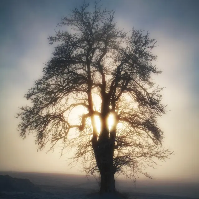
𝗨𝗻 𝗶𝗻𝘀𝘁𝗮𝗻𝘁 𝘀𝘂𝘀𝗽𝗲𝗻𝗱𝘂 𝘀𝗼𝘂𝘀 𝗹𝗲𝘀 𝗹𝘂𝗲𝘂𝗿𝘀 𝗯𝗿𝘂𝗺𝗲𝘂𝘀𝗲𝘀 𝗱𝗲 𝗹'𝗵𝗶𝘃𝗲𝗿. 💛💫 On oublie souvent que la nature peut nous éblouir par sa simplicité. Ici, @yoann.rivet.photographe nous emmène vivre un pur instant de magie : face à cet arbre solitaire, la lumière perce ses branches et nous invite à la contemplation. 😌 Comme un rappel à se reconnecter à soi et retrouver l'inspiration et la sérénité. ✨ 𝗘𝘁 𝘃𝗼𝘂𝘀, 𝗾𝘂'𝗲𝘀𝘁-𝗰𝗲 𝗾𝘂𝗶 𝘃𝗼𝘂𝘀 𝗶𝗻𝘀𝗽𝗶𝗿𝗲 𝗲𝘁 𝘃𝗼𝘂𝘀 𝗿𝗲𝘀𝘀𝗼𝘂𝗿𝗰𝗲 ? Dites-nous tout en commentaire. 💬 Un grand merci à @yoann.rivet.photographe pour cette sublime photo. 📸🙏 #saleve #hiver #montsdugenevois #hautesavoie #france
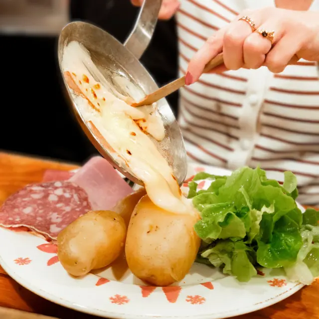
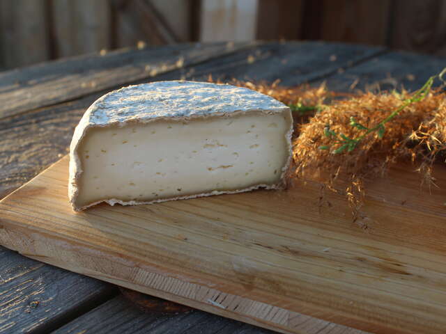
𝗘𝗻 𝗽𝗮𝘆𝘀 𝘀𝗮𝘃𝗼𝘆𝗮𝗿𝗱 𝗲𝘁 𝗺𝗲̂𝗺𝗲 𝗮𝗶𝗹𝗹𝗲𝘂𝗿𝘀, 𝗼𝗻 𝗳𝗼𝗻𝗱 𝘁𝗼𝘂𝘀 𝗽𝗼𝘂𝗿 𝗲𝗹𝗹𝗲… 𝗲𝘁 𝘃𝗼𝘂𝘀 ? 🧀😋 Aujourd’hui, c’est la 𝗝𝗼𝘂𝗿𝗻𝗲́𝗲 𝗺𝗼𝗻𝗱𝗶𝗮𝗹𝗲 𝗱𝗲 𝗹𝗮 𝗿𝗮𝗰𝗹𝗲𝘁𝘁𝗲 ! Et dans les Monts du Genevois, on prend cette fête très au sérieux ! 😉 Quand les soirées se rafraîchissent et que les montagnes se parent de blanc, rien de plus réconfortant qu’un fromage fondant, des pommes de terre fumantes et une tablée qui rit aux éclats. On adore ces instants où tout ralentit : on coupe, on gratine, on partage… et on se ressert, bien évidemment ! Et vous, vous la préférez comment ? Classique, généreusement servie ou avec une touche locale et créative ? 🤗 𝗦𝗼𝗿𝘁𝗲𝘇 𝗹’𝗮𝗽𝗽𝗮𝗿𝗲𝗶𝗹, 𝗰𝗲 𝘀𝗼𝗶𝗿 𝗰’𝗲𝘀𝘁 𝗼𝗳𝗳𝗶𝗰𝗶𝗲𝗹𝗹𝗲𝗺𝗲𝗻𝘁 𝗹𝗮 𝘀𝗼𝗶𝗿𝗲́𝗲 𝗿𝗮𝗰𝗹𝗲𝘁𝘁𝗲 ! 🔥 📸 1 : @brice_svsnk | 2 : @ludovicfremondiere #raclette #fromage #montsdugenevois #hautesavoie #france
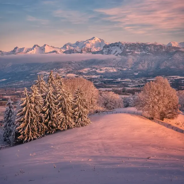
𝗗𝗲𝘀 𝗰𝗼𝘂𝗹𝗲𝘂𝗿𝘀 𝗽𝗮𝘀𝘁𝗲𝗹𝘀 𝗮𝘂𝘅 𝘀𝗼𝗺𝗺𝗲𝘁𝘀 𝗲𝗻𝗻𝗲𝗶𝗴𝗲́𝘀, 𝗹𝗲 𝗦𝗮𝗹𝗲̀𝘃𝗲 𝘀𝘂𝗯𝗹𝗶𝗺𝗲 𝗹𝗲𝘀 𝗱𝗲́𝗰𝗼𝗿𝘀 𝗲𝗻𝘃𝗶𝗿𝗼𝗻𝗻𝗮𝗻𝘁𝘀. 💖 Et si nous prenions le temps de vivre la magie de l’hiver ? Ici, @alpen_photographer nous emmène sur les hauteurs du Salève pour un moment hors du temps. Entre cimes teintées de rose et lumière tamisée, un véritable spectacle à ciel ouvert s’ouvre à nous. 😍 Et vous, quel est votre plus beau souvenir sur le Salève ? ✨ Dites-nous tout en commentaire. 💬 Un grand merci à @alpen_photographer pour cette sublime photo. 📸🙏 #saleve #hiver #montsdugenevois #hautesavoie #france
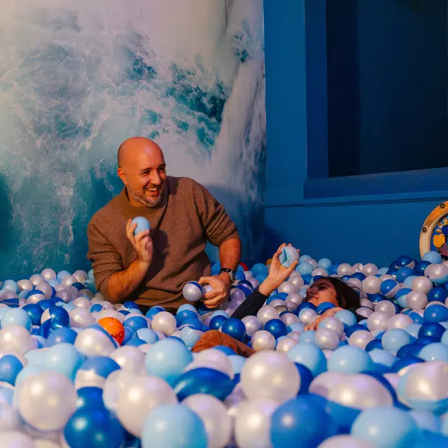
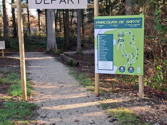
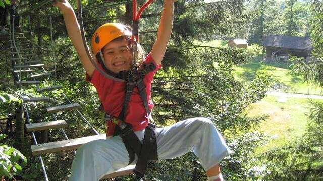
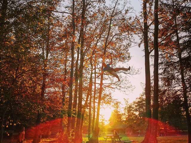
𝗟𝗮̀ 𝗼𝘂̀ 𝗹’𝗮𝘃𝗲𝗻𝘁𝘂𝗿𝗲 𝗿𝗲́𝘃𝗲𝗶𝗹𝗹𝗲 𝗹’𝗲𝗻𝗳𝗮𝗻𝘁 𝗾𝘂𝗶 𝗲𝘀𝘁 𝗲𝗻 𝘃𝗼𝘂𝘀 ! 🧒🎯 Nous voici dans un lieu hors du temps, où chaque défi nous pousse à observer mieux, réfléchir plus vite… et jouer comme un enfant. Ici, @crazyschool74 nous ouvre ses portes pour vivre des moments où l’on se reconnecte, ensemble, en dehors du quotidien. ☺ Prêts à relever le prochain défi ? 👀🔥 Entre réflexion, créativité, agilité et sang-froid, on ne demande qu'à s’entraider, se dépasser, mais surtout... à rire ! 😄 📸 @celineducrettet #indoor #escape #activities #explore #montsdugenevois #hautesavoie #alpes #frenchalps #hautesavoiemontblanc #auvergnerhonealpes #france
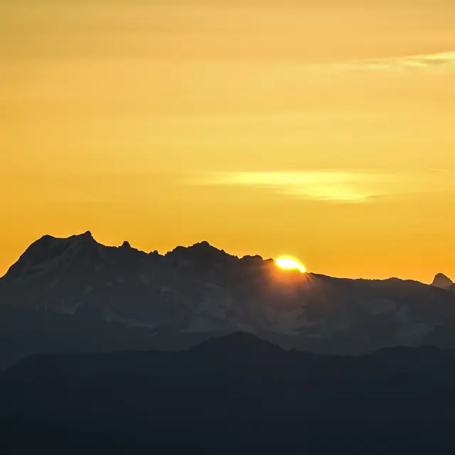
𝗔̀ 𝗹’𝗮𝘂𝗯𝗲 𝗱𝗲𝘀 𝗽𝗿𝗲𝗺𝗶𝗲̀𝗿𝗲𝘀 𝗹𝘂𝗲𝘂𝗿𝘀 𝗱𝘂 𝗷𝗼𝘂𝗿. 🌄 L'hiver approche, l'air est plus vif et le silence s’installe doucement. Pendant que la neige recouvre nos paysages, Julien (@lmr_photo_paysage) nous emmène ici pour admirer le soleil se lever lentement sur les sommets. Un spectacle teinté de lumière d’or pour nous envelopper d'un souffle chaud avant le grand froid. ❄ Un moment suspendu, simple et précieux, à savourer pleinement. ✨🫶 Reconnaissez-vous ces sommets ? Dites-nous tout en commentaire ! 💬 📸 Merci @lmr_photo_paysage pour ce magnifique cliché. 🙏 #explore #landscape #mountain #saleve #autumn #winter #sunrise #voyage #montsdugenevois #hautesavoie #alpes #frenchalps #hautesavoiemontblanc #auvergnerhonalpes #france